7. Scenario: briefing, profiles, segments, tasks
Translated from the Finnish manual (manual/fi); the Finnish text is authoritative.
Matches version: 0.4-dev (phase 4b, 2026-10-26). Status: works: situation picture, task queue, report searched, coverage and POD.
What the team gets on arrival
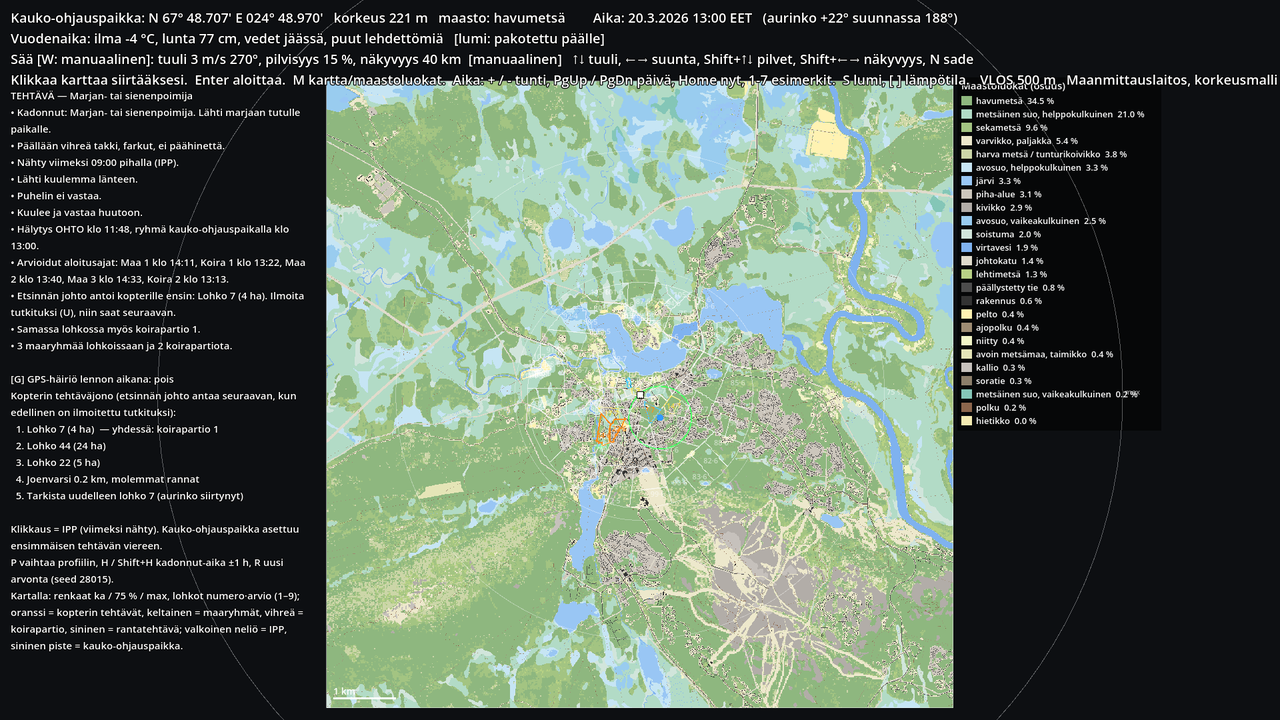
The left side of the planning map is the mission (chapter 6): the missing person's profile, clothing, last seen, direction, phone, alert and arrival time. The map shows the search leader's situation picture as it is handed over: IPP (white square), statistical rings (mean, 75 %, max) for the missing person's profile, segments numbered (number·rating, rating 1–9 from five assessors as in the MSO guide), ground team segments in yellow and the dog party's in green. The authority leads: it gives the drone a task queue (orange segments and possibly a blue shore task: "river bank, both banks"), one at a time. The drone's segment can be the same one a ground team is already in.
During the flight
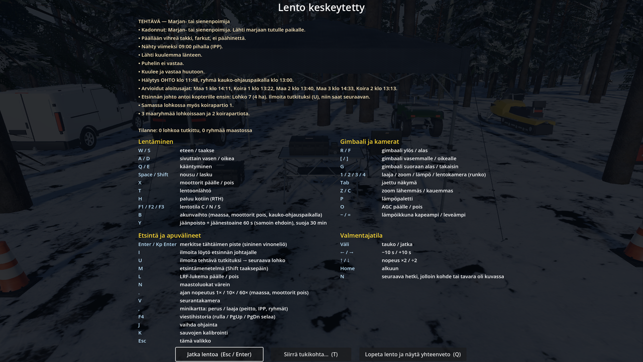
The top right corner shows the current task and the selected method (chapter 8). On the minimap the task is orange, and green shading shows what the camera has already covered and how probably (POD).
- M / Shift+M: search method. The search leader gives only the area; the team's mission lead decides the method.
- U: report the task searched. Coverage and POD are logged, and the search leader gives the next task from the queue. When the queue is empty: "no new task".
Segment boundaries and recheck
Segments are bounded by lines visible on the ground — roads, paths, streams, shores, power line corridors — and are about 1–8 ha near the IPP, at most about 30 ha further out; a large unbroken forest is split with a straight line. At the end of the task queue there may be a recheck: the search leader asks for the first segment to be checked again once the sun has moved and the shadows fall in a different direction — at the earliest 3.5 h after the team's arrival. In a short exercise you reach it with fast-forward (.). Recheck coverage is counted from zero and the debrief compares the first and second POD.
Distractors in the thermal image
The sun warms loose rocks in open terrain, and they glow until evening as person-sized spots; wood ant mounds in conifer forest are warmer than the air by a few degrees from their own heat, even at night. There are a few of both per hectare in the search area. A mark on one of them is logged in the debrief as "distractor: rock / anthill" — not as an error, but as a topic for discussion: how do you tell it apart from a person (shape, zoom, visible light, lack of movement).
Dog parties
A summary; the full description of the dogs' work and the scent model is chapter 19.
A search has 0–3 dog parties, usually one (rarely none). The first usually works in the same segment as the drone. The drone and the dogs are normally at work before the Vapepa ground teams: the dog party is usually on site at the same time as the drone team or already earlier, rarely later; ground teams arrive 40–120 min after the drone team. The briefing has estimated start times.
The dog works by scent:
- Air scenting: the missing person and items they dropped spread scent downwind as a cone that widens and thins with distance. In a moderate wind (3 m/s) the dog picks up human scent from about 150 m, in light and strong wind from a shorter distance; in calm air the scent is only a 20–25 m pool around the source. An item's scent is weaker and fades over hours. The dog quarters ahead of the handler across the wind or by the party's own plan, close or ranging freely further out, and when it picks up the scent it works into the wind towards the source.
- Tracking: the ground scent of the missing person's footsteps. It weakens over time (a trail a day and a half old can be followed in good conditions); rain, heat and strong wind wear it down faster. The dog moves along the trail on its upwind side, a few metres from the footsteps, towards the fresher end.
- Fatigue: the dog works about 3 hours (less in heat, about 1.5 h at +30 °C), then rests for an hour; in the last half hour the nose is weaker.
The dog can find the missing person itself: the radio says "the dog indicates — the missing person is found", and the debrief logs both the drone's and the dog's finds. When the drone marks a find (for example a bucket), the nearest free dog party goes to it to pick up the trail and, while on the trail, reports every five minutes which way the trail continues. That is a hint for the drone, not the answer. A party that is resting or has not yet arrived does not go.
The default values come from the literature and are to be checked with the society (sim/scent.gd, sim/dog_agent.gd, sim/snowpack.gd).
Coverage and POD
The simulator keeps a 4 m grid over the search area. Every tenth of a second the active camera's footprint is projected onto the ground, and every cell under it gets a probability of detection that depends on the camera (wide, zoom, thermal), distance, terrain class (open bog good, conifer forest poor), canopy cover, thermal contrast (thermal camera), light (visible light) and speed (over 4 m/s reduces it). A cell's POD is 1 − Π(1 − p) over all overflights; the task's POD is the mean of the cells. A ground team's or dog party's POD in the same segment (defaults 60 % and 70 %) is combined with the drone's POD using the same formula. The numbers are visible constants in scenario/pod_model.gd and are tuned with the society; they are not validated.
The debrief (chapter 9) lists per task: covered %, sweep count, POD drone / teams / total, mean altitude and speed flown compared with the method's limits, share of time on the thermal camera — and tells which task the missing person was actually in.